Français / French
 English / Anglais

High-resolution drone cartography services
Google has been using the combined technologies of aerial imagery and photogrammetry since 2005 for its popular Google Maps™ service. However, as Google tries to offer global coverage for its platform, it uses aerial images taken from satellites in orbit at very high altitudes around the earth. This results in a rather limited image resolution which is even downright unusable at times. Their images often date back from several years ago and are also not royalty free.
Our customized drone mapping services address all of these shortcomings by providing you with all-in-one low-level aerial survey production on an on demand basis, ranging from moderate to ultra-high resolutions to better meet your needs. Watch the following video to discover our drone cartography and mapping technology: a powerful tool still very unknown to the general public.
Photogrammetric mapping surveys
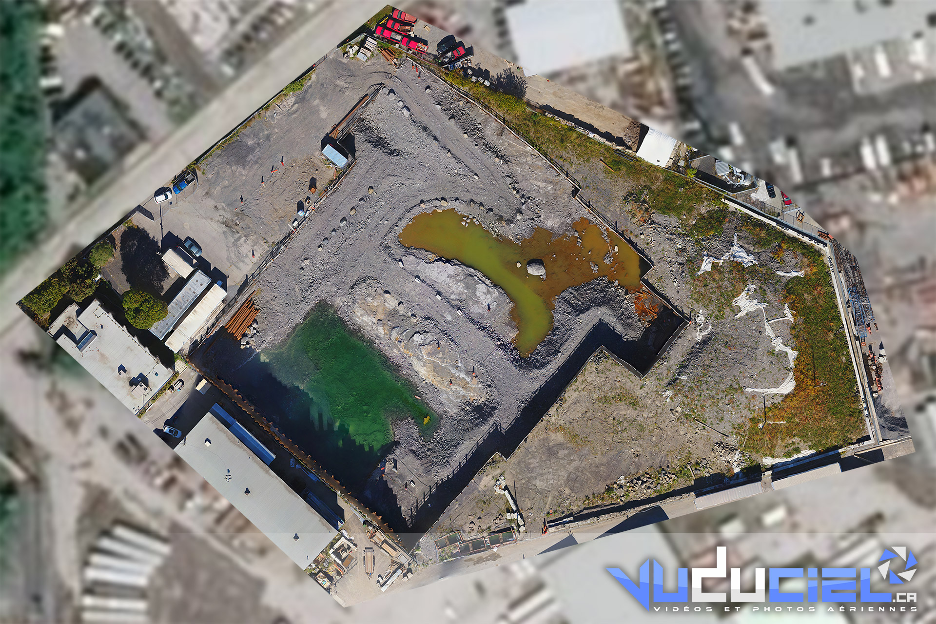
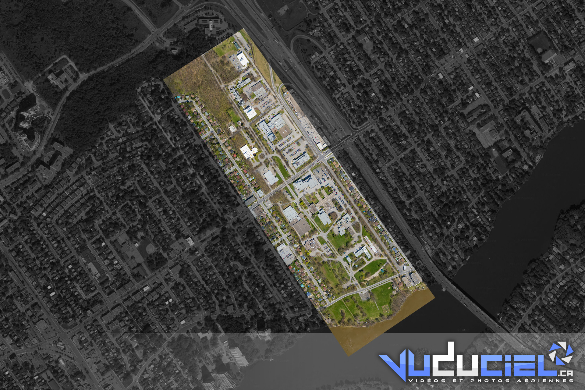
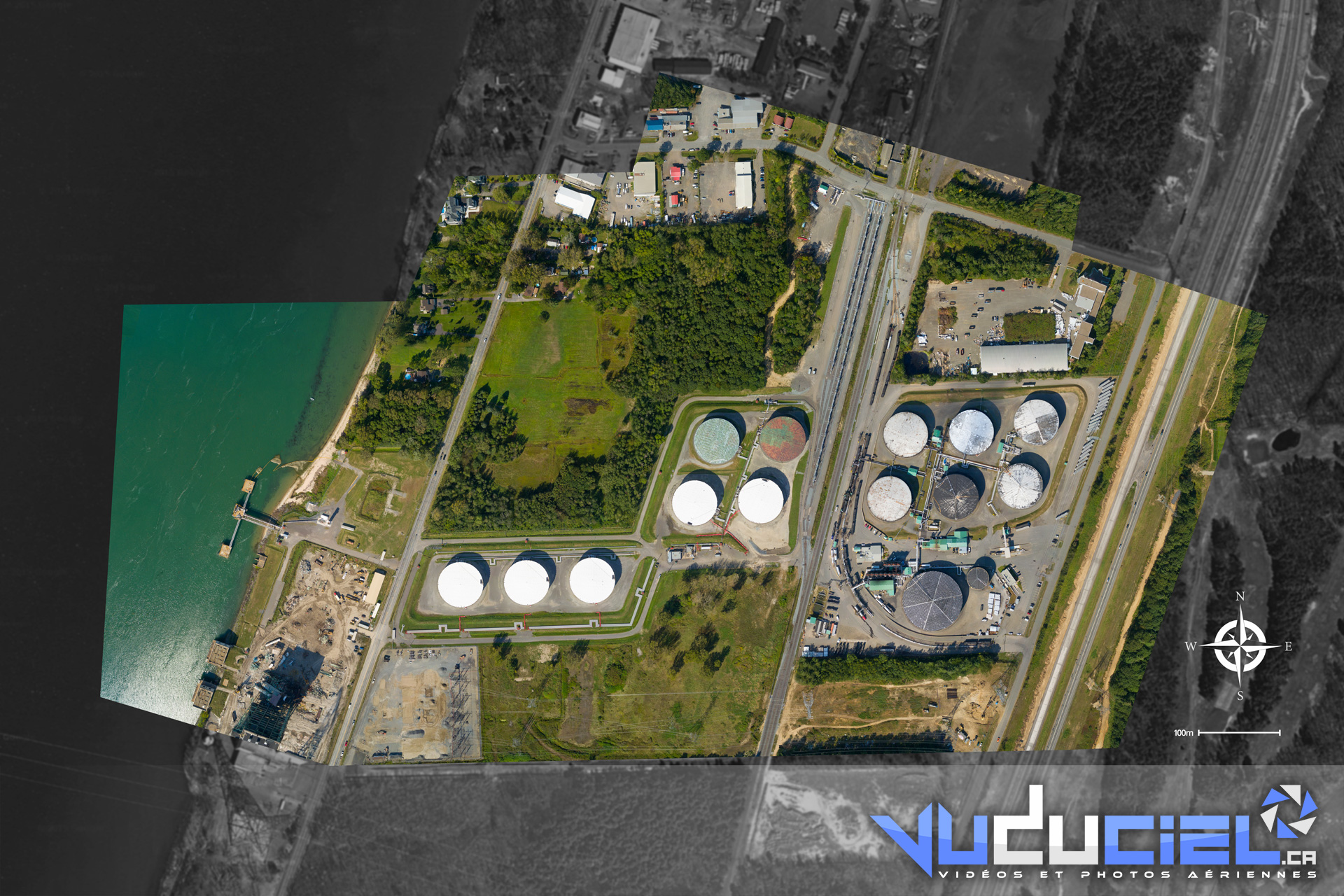
Photogrammetry is a technique that consists in reconstructing a scene using the parallax obtained between images acquired from different points of view. Inspired by the stereoscopic human vision, this technique uses advanced softwares to calculate correlation between photographs and rests entirely on the rigor in their acquisition in order to reconstitute an exact copy of the reality. Although it may initially seem trivial, aerial photogrammetry provides an astonishing level of precision in the readings and has been used for decades in various fields of expertise such as cartography, topography, architecture, geology, police investigations and archeology.
Since the biggest part of the work involved is in processing the images (an average of 24 hours of processing per map), the actual intervention by our team on your property is usually short and non-intrusive. Depending on the desired resolution of the final rendering, the use of our drone services can scan up to 500 acres of terrain per hour.
Once the acquisition of the images is complete, our technicians begin processing your data, refine the output and then deliver your maps to your inbox in the electronic format of your choice; no additional software needed!
Once only known and used by government agencies, the true power of photogrammetry is now available to the general public through our specialized drone mapping services. How? Nothing’s easier! Contact us today to get more details on this really exciting technology.
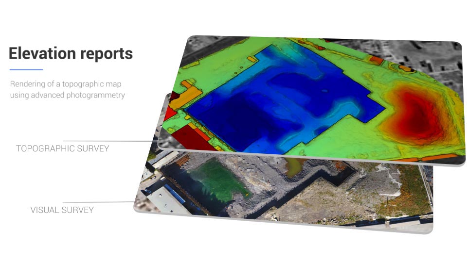
Topographic surveys and elevation reports
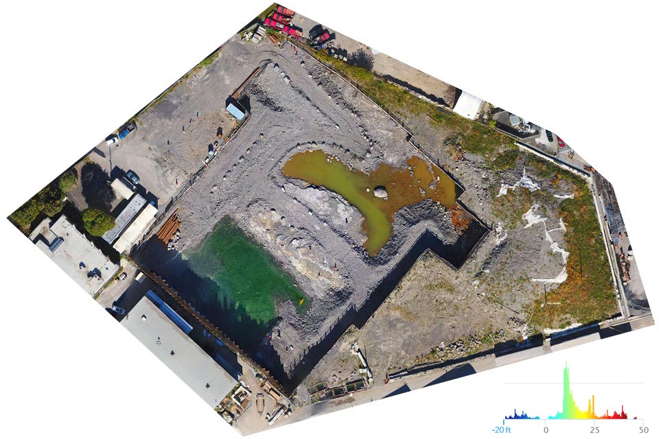
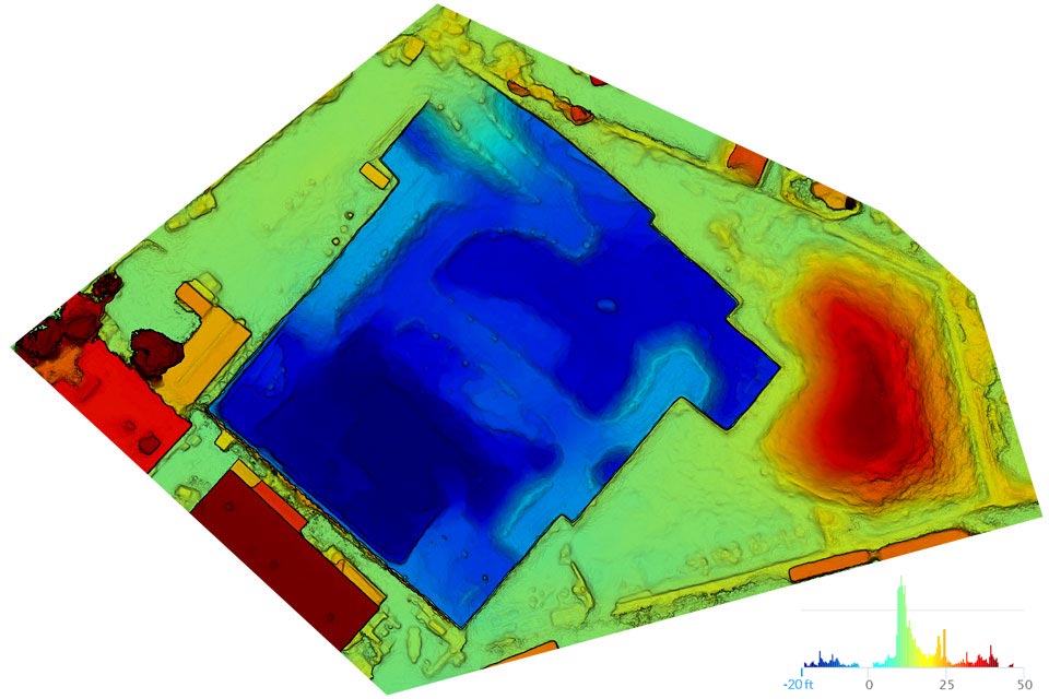
As photogrammetric calculations are not limited to a two-dimensional space as in the case of a conventional paper map, they can very well digitize a terrain as much as a structure erected in heights, regardless of its shape. The resulting information makes it possible to produce a high-fidelity, color coded 2D topographic map for an easy and efficient use.
Topographic maps make it possible to visualize the relief and to evaluate the unevenness of a terrain. These elevation reports are useful for measuring the slope of a steep terrain, calculating the height of different buildings, or even to know in advance the path that water would take during a flood.
The topographic map rendering is included with most of our drone mapping services.
3D models
Photogrammetry can even recreate a 3D model of the scanned area. This virtual model can then be manipulated in a very dynamic way using various free PC and Mac software. With our optional online client interface, 3D models can even be accessed and viewed right in your web browser.
Whether it’s intended purpose is to visit a property, keep track of the progress at a construction site, coordinate operations, perform calculations or to assess a structure, nothing is as powerful as a high-resolution 3D modeling of your address captured by VuDuCiel‘s drone.
We take care of everything, from the appointment of our drone to your address right to the digital delivery of your surveys in the form of a cartographic and a topographic map, both in standard JPEG format, as well as the rendering of your 3D model in a OBJ format.
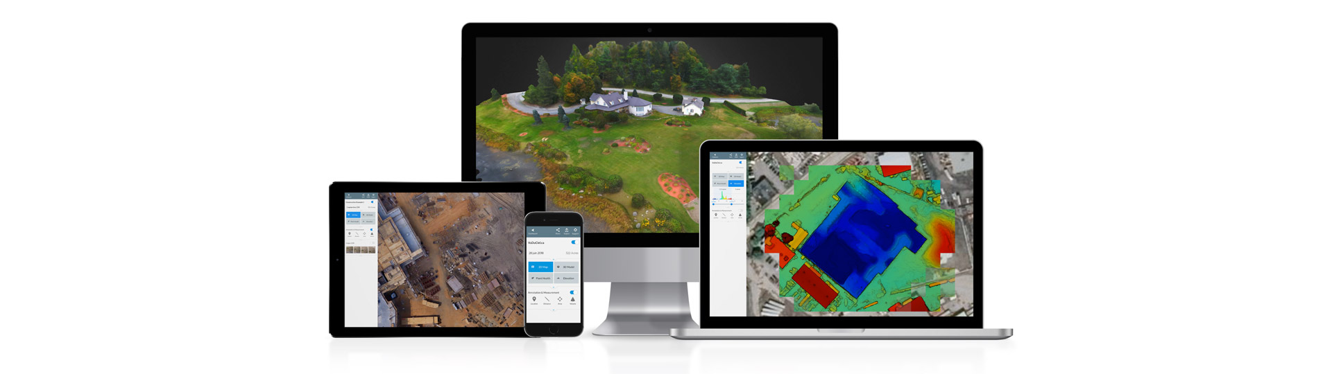
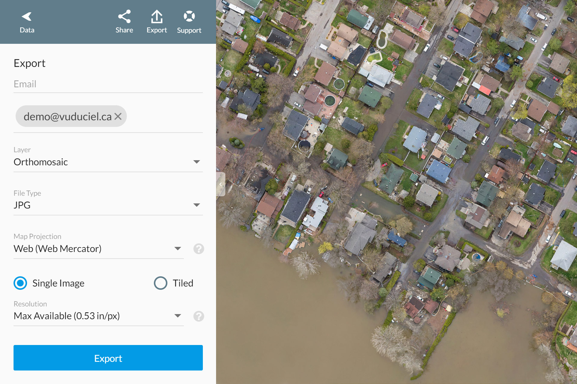
Web-based multiplatform client interface
Available as an optionnal complement to our drone mapping services, the web-based multiplatform map management interface allows for the interactive viewing of your maps on most of your computer devices, from your desktop computer to your tablet, your laptop and even your smartphone. Easy to use, it is a versatile and extremely powerful tool that will reinvent the way you view and use your maps.
This interface gathers all your maps in one place in a very organised way and allows you to consult them on demand, wherever you are and with whom you want. A simple and clear menu allows you to switch between the satellite, topographic and 3D model versions of your surveys. The navigation through the various maps is intuitive, using your mouse or the movements of your fingers on a touchscreen, exactly like when using Google Maps™.
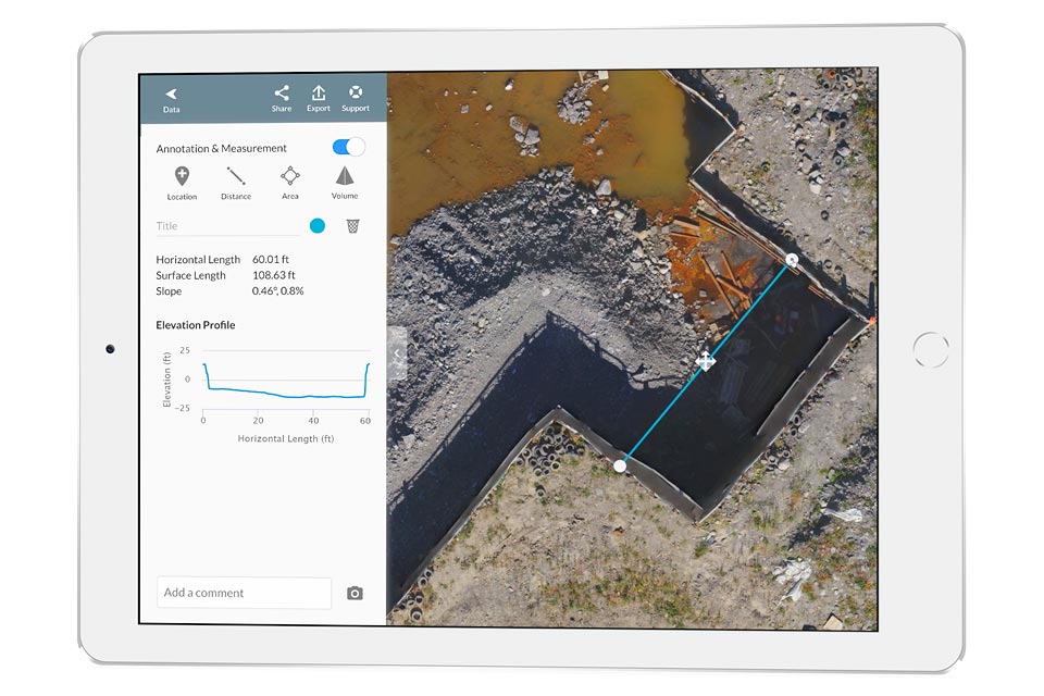
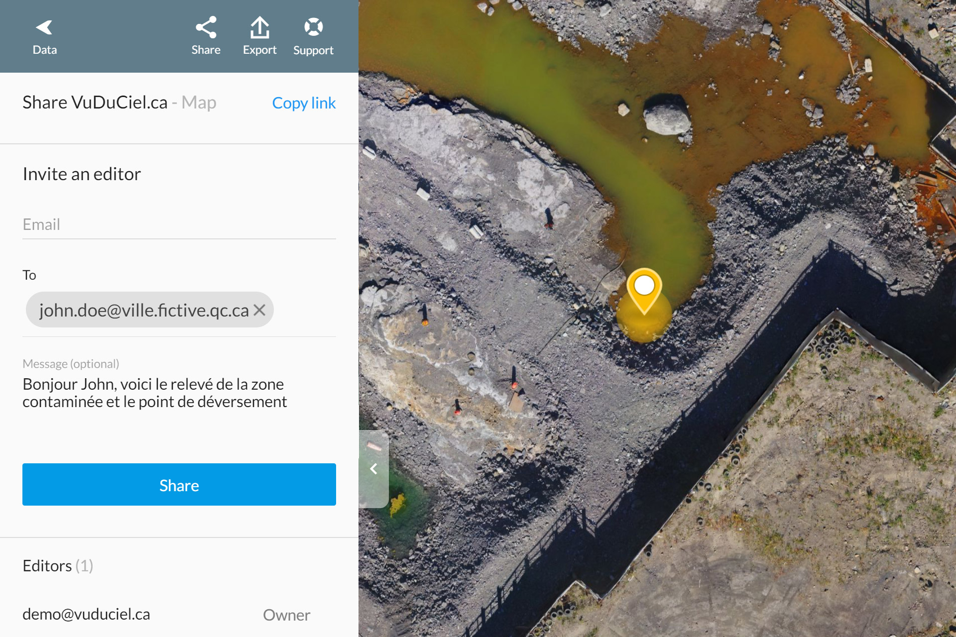
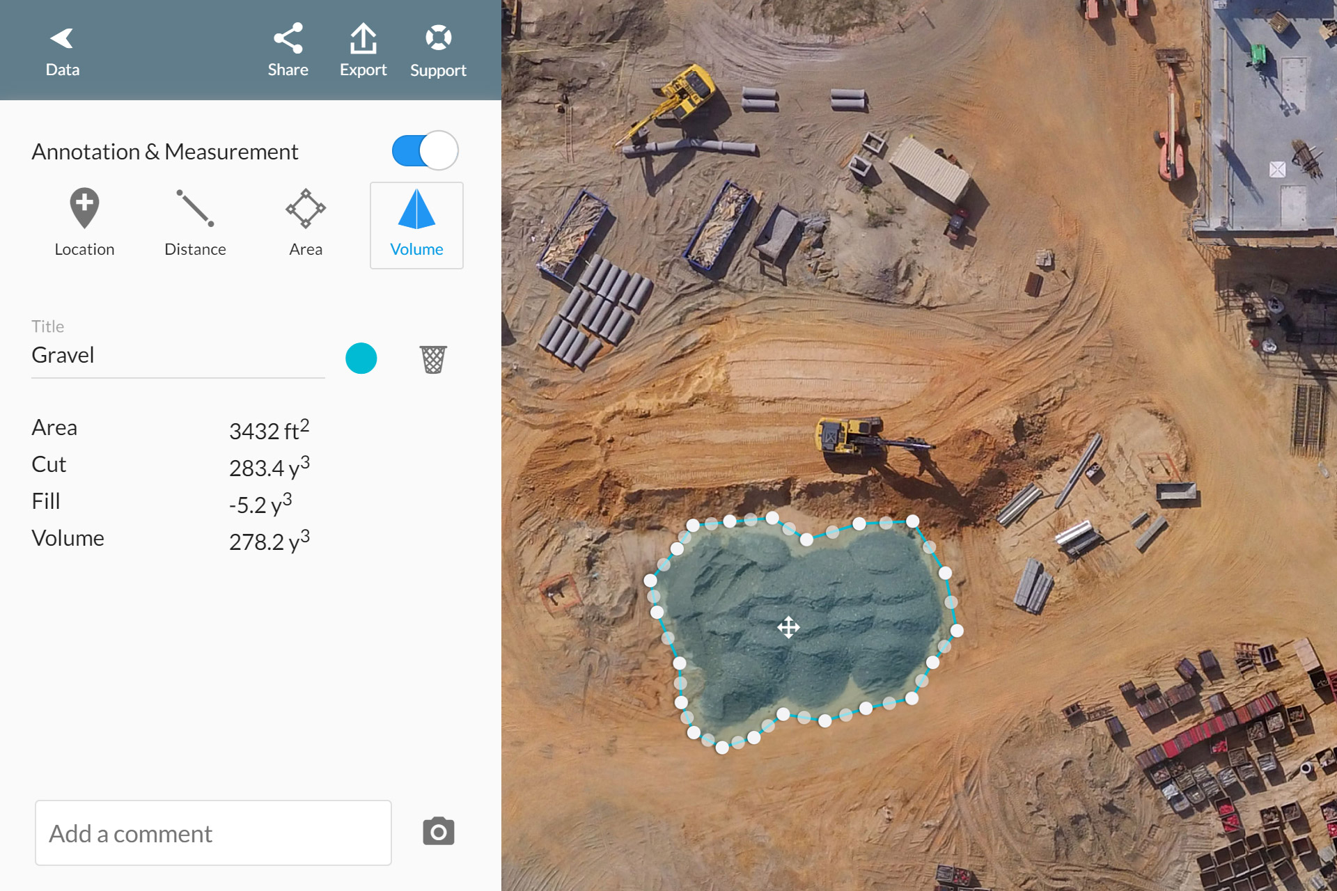
The advanced software of the map manager also gives access to a variety of advanced features such as map sharing and cooperation with multiple users, the addition of annotations in real time, the calculation of various measurements in 2D and 3D environments right from your browser (distances, areas, volumes, etc.) as well as exporting your maps in various standard digital formats.
It is a brand new technology that integrates perfectly with various economic sectors (governmental, industrial, construction, real estate, private, etc.). If you are intrigued or curious to learn more about our drone mapping services, contact us and we will be more than happy to help you out.
Multiuser sharing
Live annotations

Interactive measurements
Exporting tools